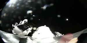
The first Google logo to orbit the planet made its maiden voyage on Saturday attached to the GeoEye-1 geospatial photography satellite.
The satellite, referred to by CNet as part of the US National Geospatial Intelligence Agency's NextView programme, allows both colour and monochrome photography of as high as 82 cm resolution – far in excess of the detail previously available.
Although primarily for military use, the GeoEye-1 will also prove handy for Google: the search company has landed the exclusive rights to use imagery provided by the satellite for its Maps and Earth packages. While the really impressive stuff – i.e. the photography high-resolution enough to read a paper's headlines when left on a doorstep – will be kept back for military use only, the enhanced quality footage will give Google's mapping services a distinct edge over its competitors.
The Saturday launch – attended by Larry Page and Sergey Brin – took place from the Vandenberg Air Force Base in California, where the satellite ascended on-board a Delta II rocket module. Thankfully, the rather risky sequence went off without a hitch with seperation from the second stage confirmed that afternoon and all on-board systems passing initial checks.
GeoEye-1 will be snapping surfaces near your from 423 miles above starting in the next few days, with a sister satellite – called, surprisingly enough, GeoEye-2 – due in 2011. In the meantime, expect to see the quality of imagery available on Google Earth dramatically improve.
Do you applaud Google for getting the exclusive rights to GeoEye-1's imagery, or does the thought of everyone's favourite NSA black-op being able to see what you're wearing sound a trifle worrying? Share your thoughts over in the forums.

MSI MPG Velox 100R Chassis Review
October 14 2021 | 15:04


Want to comment? Please log in.