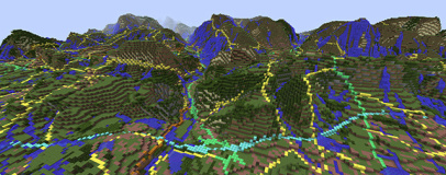
The British Geological Survey (BGS) has turned to a novel new method for sharing information on the geology of Great Britain: Minecraft.
The data, shared as a resource pack, covers mainland Britain and its smaller surrounding islands, and plonks the user down at the BGS Cardiff office as a starting location. The surface of the island is covered in Ordnance Survey mapping data, but it's when you start digging that you discover what the BGS has brought to the table: real geology, recreated in Minecraft block types.
A team of geologists created a mapping table of real-world material types to Minecraft equivalents in order to create a rough reproduction of each area's geology. Some mappings are obvious, other less so: areas of sand are represented by sand blocks, as you might expect; peat bogs, meanwhile, use the soul sand block type, as its sinking characteristics were decided to be as close to peat as possible in the game.
The blocks types and locations are based on the BGS soil parent material map, used to offer a generalised understanding of the types of geology found in Great Britain and their locations. Minecraft, meanwhile, was chosen for its appeal. 'This work is an outstanding opportunity to get people using Minecraft, especially youngsters, to understand the geology beneath their feet and what it can be used for,' claimed Professor John Ludden, executive director of the BGS.
The resource pack, which takes up a massive 5.4GB of hard drive space, can be downloaded for use with registered editions of Minecraft from the BGS website. Those looking for more detail can download similar data for other applications as part of the BGS GB3D project.

MSI MPG Velox 100R Chassis Review
October 14 2021 | 15:04


Want to comment? Please log in.